Convert your data into
Convert your vector or raster GIS/CAD data to various other formats and coordinate systems...
Online GIS / CAD Data Conversion and Transformation Tool
- Formats conversions
- Coordinate systems transformation
- Both vectors and rasters supported
- Bulk conversions

CAD formats support
MyGeodata Converter supports several CAD formats you can convert to various GIS formats.
- DXF, DGN, DWG formats supported
- Coordinate system assignment

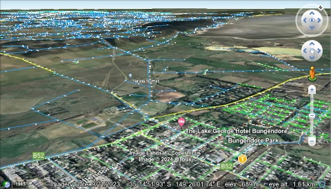
Display your data in Google Earth
The Converter allows to convert data to formats suitable for Google Earth.
- KML/KMZ output format
- Easy to use
- Offline or online viewer

Use our tools for data processing
Perform further geodata processing with Geoprocessing Online tools.
- Many geodata processing tools
- Available online
Supported geodata formats
MyGeodata Converter supports many vector and raster GIS and CAD formats - explore support for your formats...
Input vector formats
- ESRI Shapefile (.shp)
- Keyhole Markup Language (.kml, .kmz)
- GeoJSON (.geojson, .json)
- Geography Markup Language (.gml)
- GPS Exchange Format (.gpx)
- AutoCAD DXF (.dxf)
- GeoPackage (.gpkg)
- MapInfo TAB and MIF/MID (.tab, .mif, .mid)
- SQLite/Spatialite (.sqlite)
- MS Excell (.xlsx, .xls)
- Comma Separated Values (.csv)
- Open Document Spreadsheet (.ods)
- Microstation DGN (.dgn)
- AutoCAD DWG (.dwg)
- TopoJSON (.topojson, .geojson)
- ESRI File Geodatabase (FileGDB) (.gdb)
- FlatGeobuf (.fgb)
- Geospatial PDF (.pdf)
- Norwegian SOSI Standard (.sos)
- VFR RÚIAN (.gml, .xml)
- GMT ASCII Vectors (.gmt)
- Arc/Info Binary Coverage
- Arc/Info E00 (ASCII) Coverage
- UK .NTF
- IHO S-57 (ENC)
- U.S. Census TIGER/Line
- NAS / ALKIS
- Dutch Kadaster LV BAG 2.0 Extract
- Idrisi Vector (.vct)
- GRASS Vector Format
- (+ many others)
Output vector formats
- ESRI Shapefile (.shp)
- Keyhole Markup Language (.kml, .kmz)
- GeoJSON (.geojson, .json)
- Geography Markup Language (.gml)
- GPS Exchange Format (.gpx)
- AutoCAD DXF (.dxf)
- GeoPackage (.gpkg)
- MapInfo TAB and MIF/MID (.tab, .mif, .mid)
- SQLite/Spatialite (.sqlite)
- MS Excell (.xlsx, .xls)
- Comma Separated Values (.csv)
- Open Document Spreadsheet (.ods)
- Microstation DGN (.dgn)
- TopoJSON (.topojson, .geojson)
- ESRI File Geodatabase (FileGDB) (.gdb)
- FlatGeobuf (.fgb)
- Geospatial PDF (.pdf)
- GMT ASCII Vectors (.gmt)
Input raster formats
- GeoTIFF File Format (.tif)
- Arc/Info ASCII Grid (.asc, .grd, .txt)
- GeoPackage raster (.gpkg)
- Geospatial PDF (.pdf)
- ASCII Gridded XYZ
- ESRI .hdr Labelled
- JPEG JFIF File Format (.jpg)
- JPEG2000 (.jp2)
- MBTiles (.mbtiles)
- Portable Network Graphic (.png)
- KMLSuperoverlay (.kmz)
- Arc/Info Binary Grid
- Bathymetry Attributed Grid (BAG)
- Maptech/NOAA BSB Nautical Chart Format (BSB)
- Military Elevation Data (DTED)
- Erdas Imagine Raw
- ENVI .hdr Labelled Raster
- ERMapper .ERS
- Envisat Image Product
- Generic Binary (.hdr labelled)
- Graphics Interchange Format (.gif)
- GRASS Raster Format
- WMO General Regularly-distributed Information in Binary form (GRIB)
- Golden Software Surfer 7 Binary Grid File Format
- Golden Software ASCII and Binary Grid File Format
- Hierarchical Data Format Release 4 and 5 (HDF4, HDF5)
- Erdas Imagine HFA (.img)
- Idrisi Raster Format
- Erdas 7.x .LAN and .GIS
- OziExplorer .MAP
- Network Common Data Form (netCDF)
- OZF2/OZFX3 raster (OZI)
- Rasters in SQLite DB (.sqlite)
- Swedish Grid Maps (RIK)
- SAGA GIS Binary Grid File Format
- USGS SDTS DEM
- SRTM HGT Format
- USGS ASCII DEM (and CDED)
- ZMap Plus Grid
- WEBP
- (+ many others)
Output raster formats
- GeoTIFF File Format (.tif)
- Arc/Info ASCII Grid (.asc, .grd, .txt)
- GeoPackage raster (.gpkg)
- Geospatial PDF (.pdf)
- ASCII Gridded XYZ
- ESRI .hdr Labelled
- JPEG JFIF File Format (.jpg)
- JPEG2000 (.jp2)
- MBTiles (.mbtiles)
- Portable Network Graphic (.png)
- KMLSuperoverlay (.kmz)
- Bathymetry Attributed Grid (BAG)
- ENVI .hdr Labelled Raster
- ERMapper .ERS
- Golden Software Surfer 7 Binary Grid File Format
- Golden Software Binary Grid File Format
- Hierarchical Data Format Release 4 (HDF4)
- Erdas Imagine HFA (.img)
- Idrisi Raster Format
- Erdas 7.x .LAN and .GIS
- Network Common Data Form (netCDF)
- SAGA GIS Binary Grid File Format
- USGS ASCII DEM (and CDED)
- WEBP


"We are proud that our company is a bronze sponsor of GDAL project."
Antonin Orlik